Welcome to Puget Sound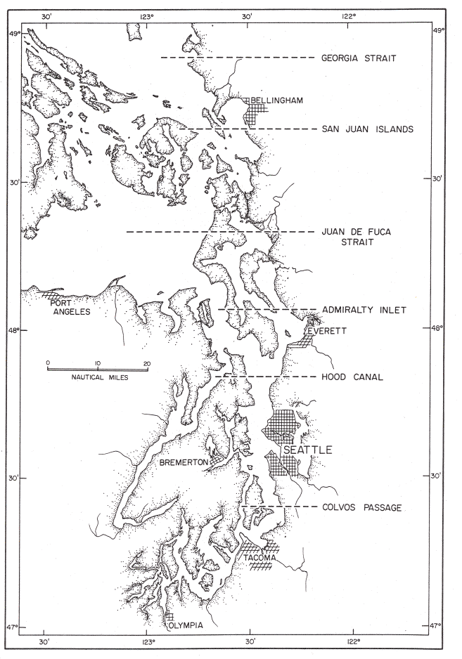
This map is modified from one found in DeLacy, Miller and Borton's Checklist of Puget Sound Fishes , Seattle Division of Marine Resources, University of Washington, 1972. Click on the map to see a larger, more legible version. About Puget SoundPuget Sound is an estuary, a semienclosed body of water in which salt water from the nearby Pacific Ocean mixes with fresh water runoff from the surrounding watershed. In general, the denser salt water sinks deeper and moves toward the land, while fresh water forms a surface layer that moves seaward. Although it averages 140 meters deep, Puget Sound has a maximum depth of 280 meters, which occurs slightly to the north of Seattle. The bottom of the Sound is made up of a series of valleys and ridges, or sills, which disrupt the movement of water and help it mix. Two of the most important sills are at Admiralty Inlet and the Tacoma Narrows. The second largest estuary in the United States, Puget Sound has 3,790 kilometers of shoreline. The average difference between high and low tide is about 3.7 meters at Seattle. This difference is large because a large volume of water continually moves in and out of the Sound with the tide. The Puget Sound watershed covers nearly 42,800 square kilometers and consists of over ten thousand rivers and streams that drain into the Sound. Over 80% of surface water flowing into Puget Sound comes from the following major river drainages: Cedar/Lake Washington canal, Duwamish/Green, Elwha, Nisqually, Nooksack, Puyallup, Skagit, Skokomish, Snohomish, and Stillaguamish. For links to more information about Puget Sound, click here . |